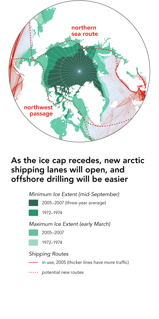
Bill Rankin, 2009
The May 2009 issue of National Geographic includes some maps I made to accompany an article on new mapping and territorial claims in the arctic. The maps I'm posting here are unpublished studies for that article.
The major trend is clear: as global warming pushes back the Arctic ice cap, shipping and offshore petroleum mining are expected to expand in step. Not surprisingly, oil companies are undertaking extensive mapping, exploration, and computer modeling to locate deposits that might be exploited in a warmer arctic.
This increased attention to the arctic, however, is also prompting new political negotiations. One of the provisions of the UN Convention on the Law of the Sea (UNCLOS) is that countries may claim mineral-extraction rights to the continental shelf outside their usual 200-nautical-mile Exclusive Economic Zone, as long as they can precisely locate the edge of the shelf according to rules included in the Convention.
All five arctic countries are now engaged in mapping and geologic missions to support huge claims to the arctic seafloor. This means that the bravado and realpolitik of, for example, Russia's seafloor flag-planting are intertwined with scientific debates about whether the Lomonosov Ridge is continental or oceanic in origin, and questions about how to define the edge of a continental shelf that does not have a typical S-shape profile. It also means that the map of the Arctic seafloor has seen huge revisions in the last few decades: seafloor ridges have been found to be hundreds of kilometers out of place, and new seamounts are still being discovered.
Data from the USGS, NOAA, UN, and Canada; oil and gas data courtesy IHS.
