Bill Rankin, 2003
download:
.PDF (302k)
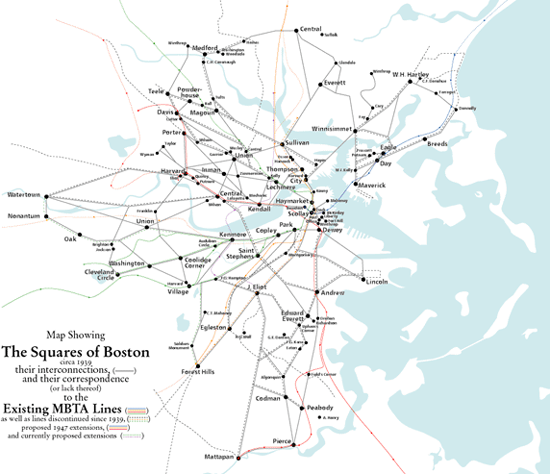
Perhaps a midly successful attempt to
1, Show Boston as a system of interconnected squares. It's a travesty that modern maps omit this basic fact of local geography.
2, Show that the pre-war mass transit system reinforced this organization, but that since the creation of the MTA (1947) and MBTA (1962), there has been a retreat from the squares, both in planning and construction. This is due in part to the financial and planning constraints on the MBTA, which must increasingly use existing rail lines and easements. But at the same time, the MBTA is clearly a regional agency whose mandate is to provide alternate routes for car commuters. Unlike the earlier private inter-square trolley lines, the MBTA is not designed to provide an alternative to walking.
