Bill Rankin, 2013
download:
.PNG (2200x2850, 315k)
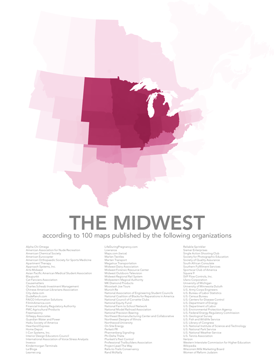
The American Midwest has no obvious boundaries; it is, at best, a collection of ill-defined ideals about landscape, labor, and culture that vaguely invoke the westward march of U.S. expansion in the nineteenth century. Unlike, say, the editors of Wikipedia, I have no interest in trying to legislate one true geography. Instead, this map takes a much messier approach. After using Google to find 100 different maps of the Midwest (with a preference for those with some official organizational status), I simply overlaid them all. The result is not a map of the Midwest as we might imagine it to be; it is instead a map of the Midwest as a complex and fragmented administrative category.
One important thing to note here is that even though Illinois emerges as the most midwestern state, there is no area that was included on every single map. (Compare, for example, these two maps of corporate sales regions.) The sum of all possible Midwests, however, is incredibly vast, stretching from Newfoundland to New Mexico and Idaho to Georgia.
The great majority of the maps I found identified the Midwest only using state boundaries, but there were also maps that used counties, area codes, ecosystems, and even freehand shapes. Some of these overlapping shapes can be seen by zooming in to Colorado, Oklahoma, and Pennsylvania.
Special thanks to Ian Everhart for brainstorming some of these ideas with me.
