Bill Rankin, 2015
download:
.PNG (2700x2700, 3.4 MB)
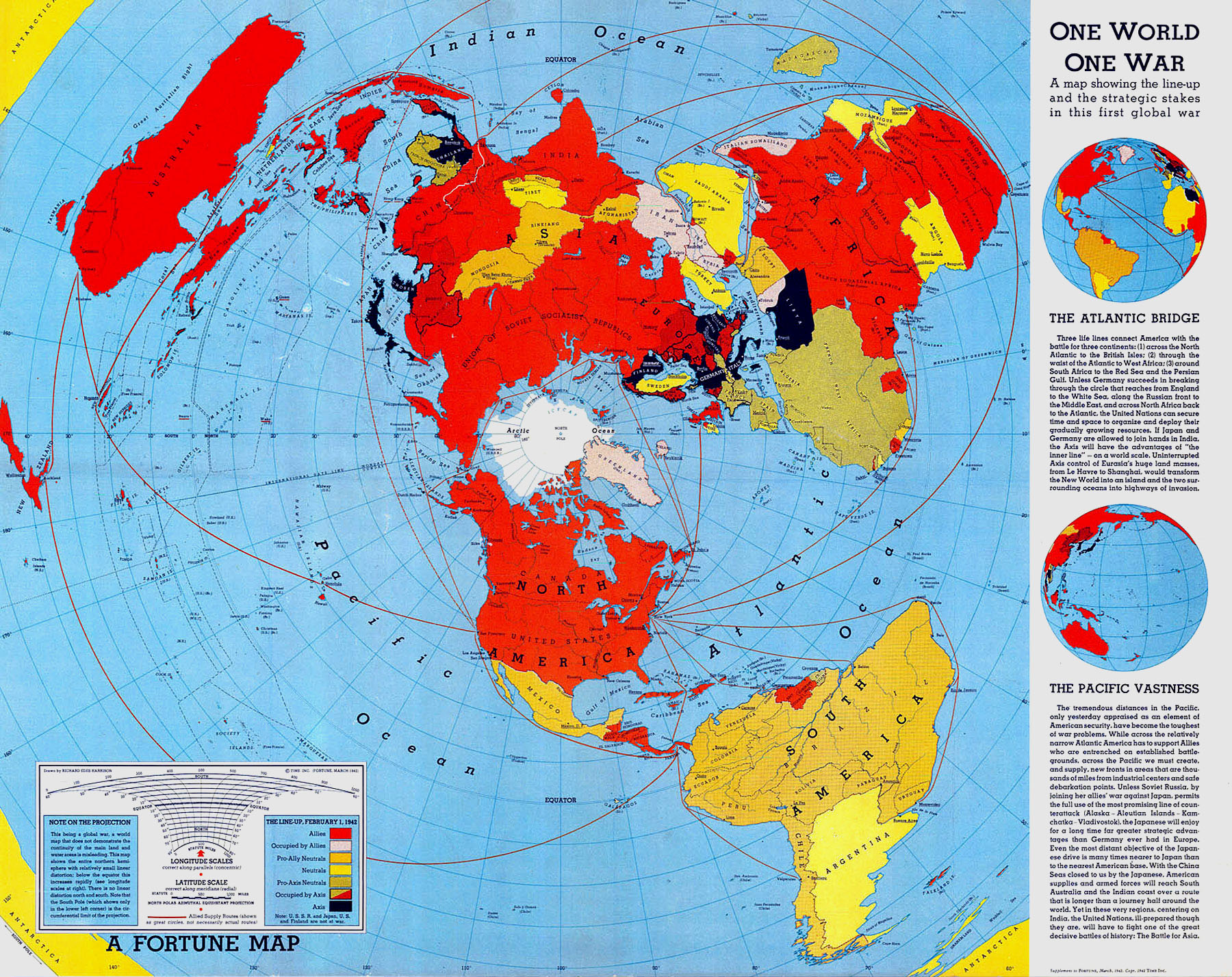
At the height of World War II, the architect-turned-cartographer Richard Edes Harrison published his famous "One World, One War" map in Fortune, which used a polar projection to show the United States in close proximity to the threats from Germany and Japan. Compared to the isolationist message of the Mercator, it made engagement with the war seem like a geographic imperative:
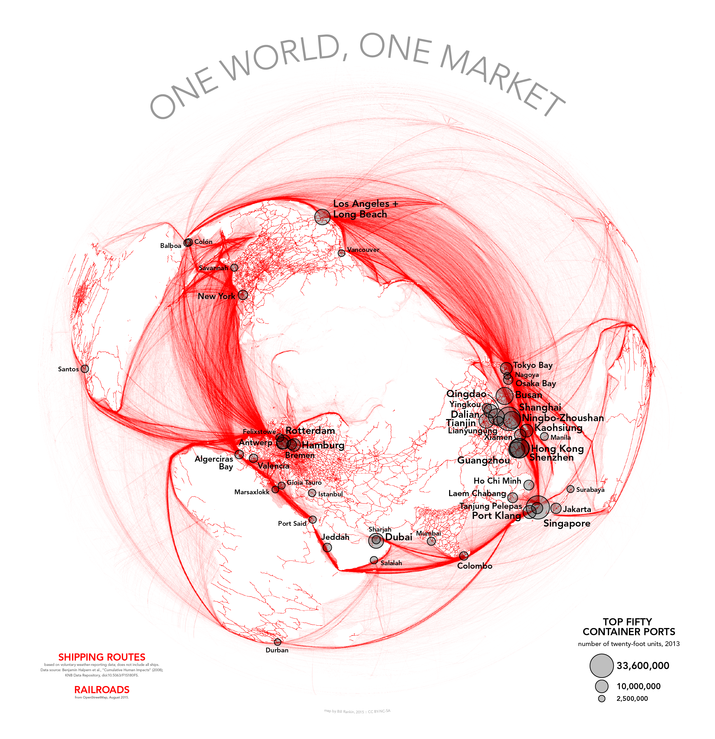
My map is a slightly tongue-in-cheek attempt to update Harrison's basic idea for the present day. Instead of showing territorial states engaged in a global war, my version uses shipping routes and railways to show the intermodal donut of global capitalism — the frenetic circulation across the North Atlantic and Pacific Oceans, the thick rope threading through the Suez Canal and the Strait of Malacca, and the offshoots to South America, Australasia, and Africa.
I also use an equal-area projection instead of Harrison's equidistant, and I've rotated the map away from the usual centers of North America and Europe.
Shipping data based on voluntary weather-reporting data, which does not include all ships. From Benjamin Halpern et al., "Cumulative Human Impacts" (2008). Railway data from OpenStreetMap, August 2015.
