Map of Yamashiro province (including Kyoto), 19th century.
The original is held by the Library of Congress.
Descriptive Map of London Poverty, by Charles Booth, 1889.
For an interactive version of his later mapping, covering more of London, see here.

A Comparative View Of The Principal Waterfalls, Islands, Lakes, Rivers and Mountains, in the Western [left] and Eastern [right] Hemisphere, by John Rapkin, 1851.
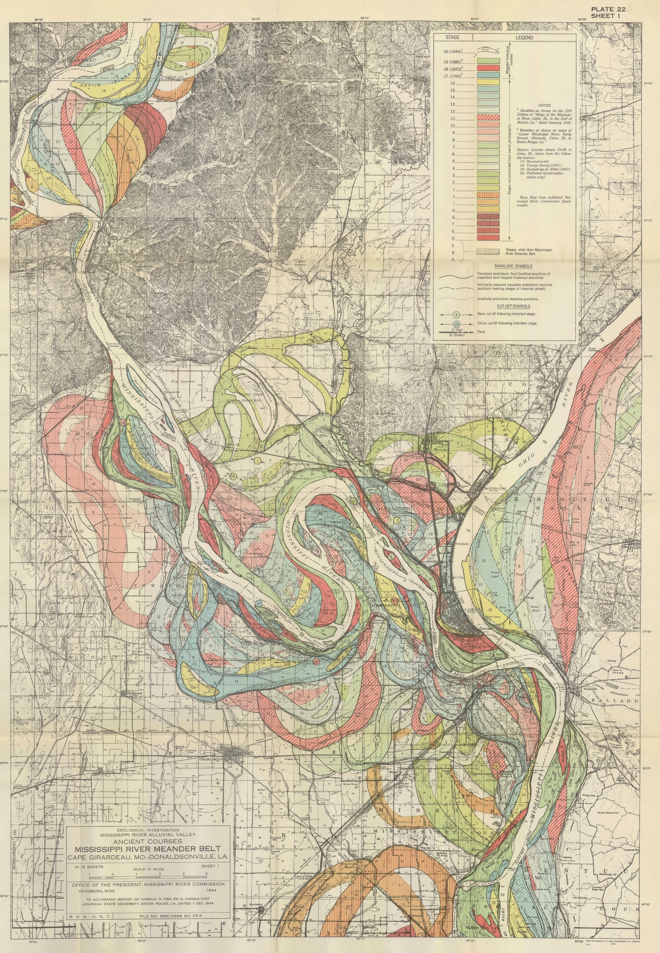
Map of the historical meanders of the Mississippi river, by Harold Fisk, 1944.
I have posted the full series here.
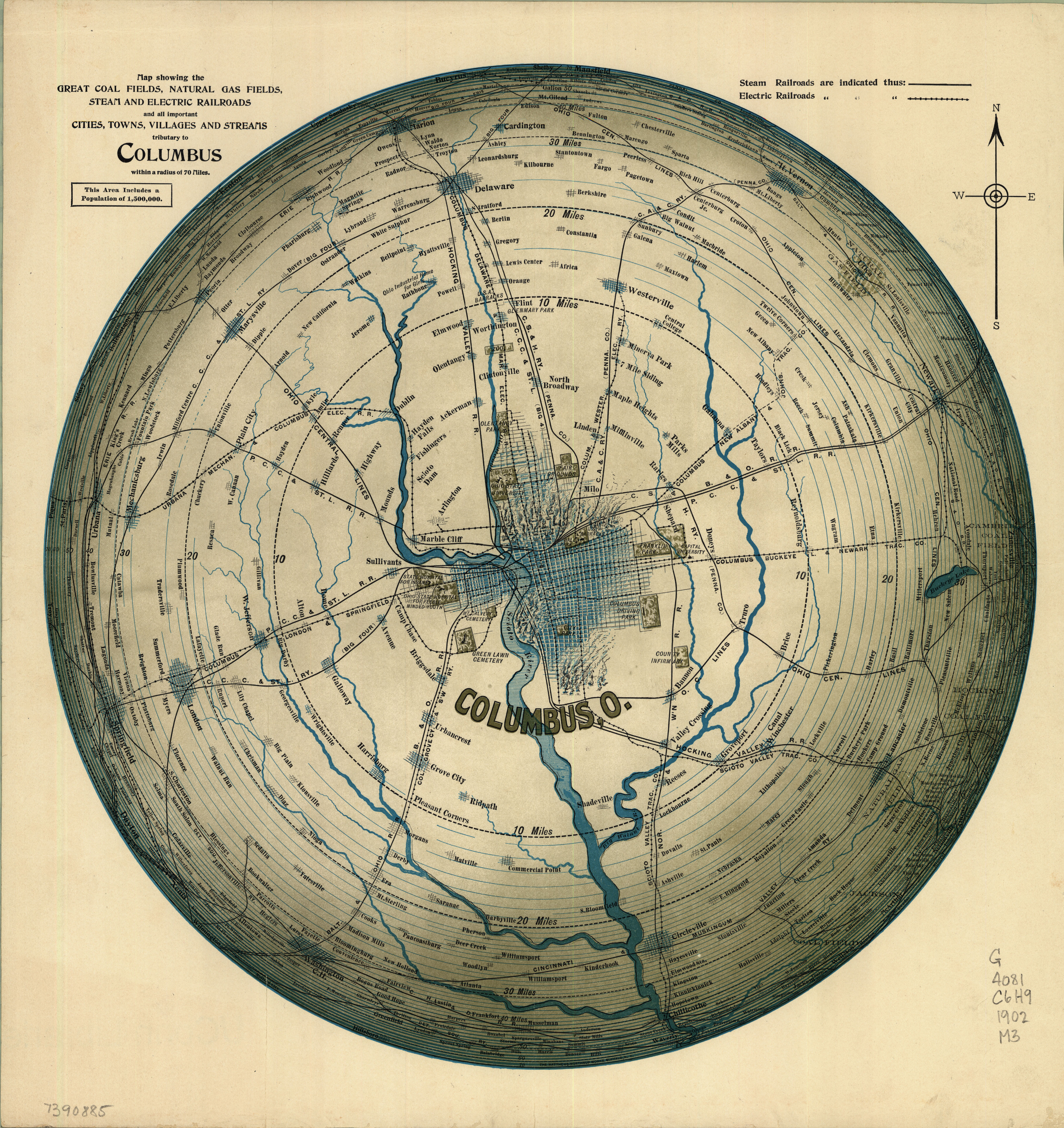
Map of the area surrounding Columbus, Ohio, 1902.
(With no apologies to Saul Steinberg.)
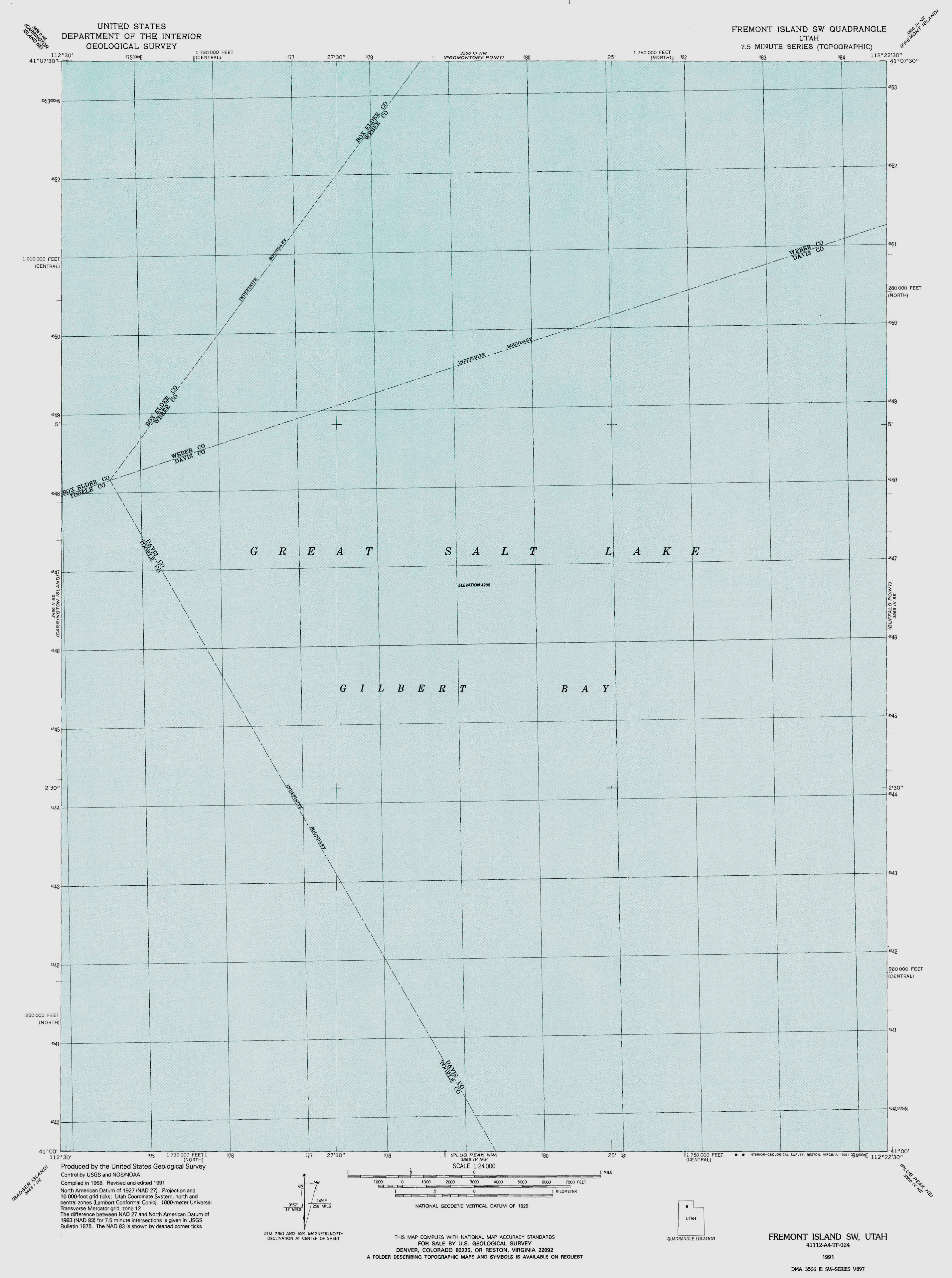
Left: map of the Great Salt Lake by the US Geological Survey, 1968. (Grid added 1991.)
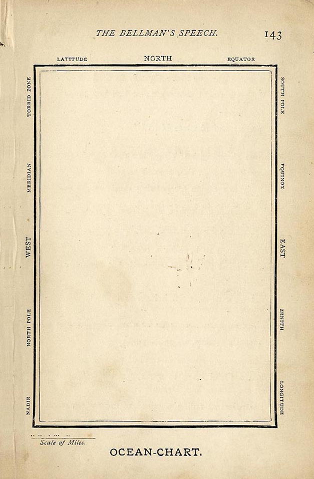
Right: map by Henry Holiday for Lewis Carroll's The Hunting of the Snark, 1876.
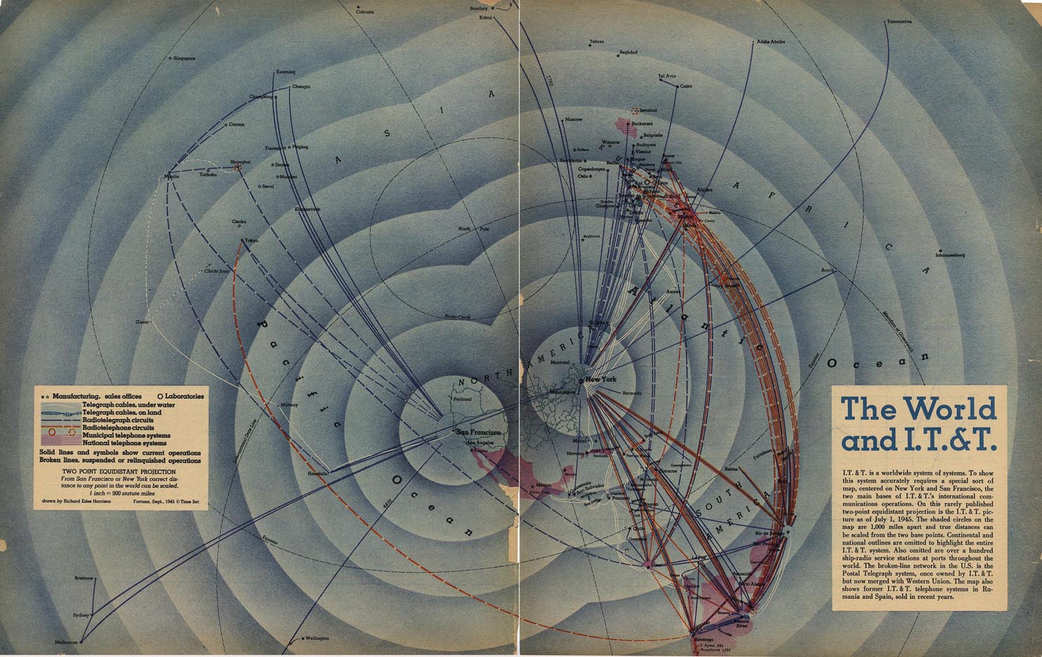
The World and I.T.&T. by Richard Edes Harrison.
From Fortune magazine, September 1945.
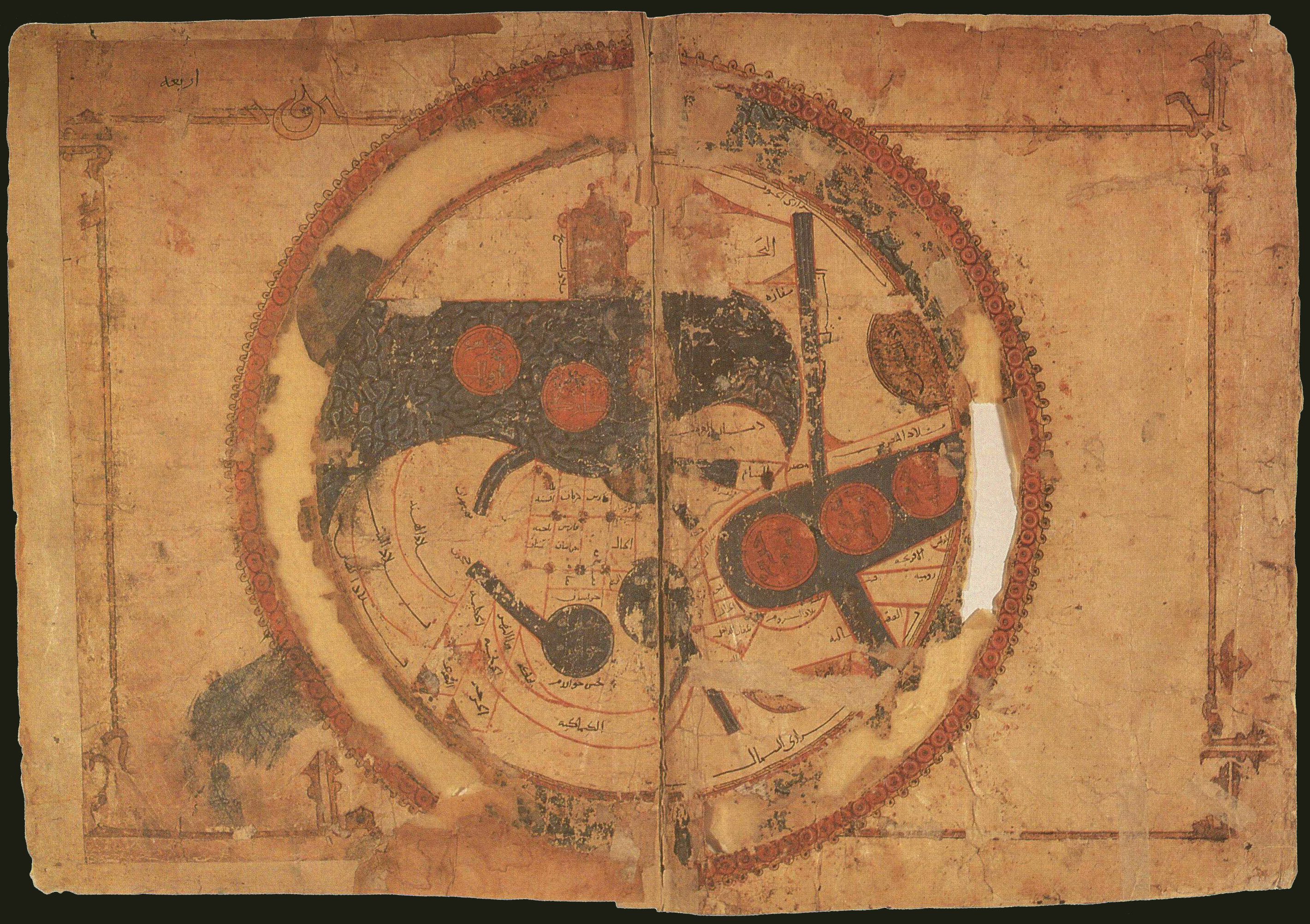
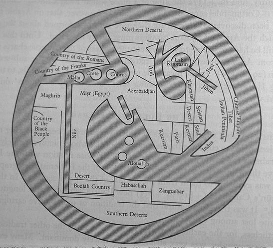
A twelfth-century copy of a tenth-century map of the world by Ibrahim Al-Istakhri. South is up.
For a translation of the map into English (with north up), see this image.
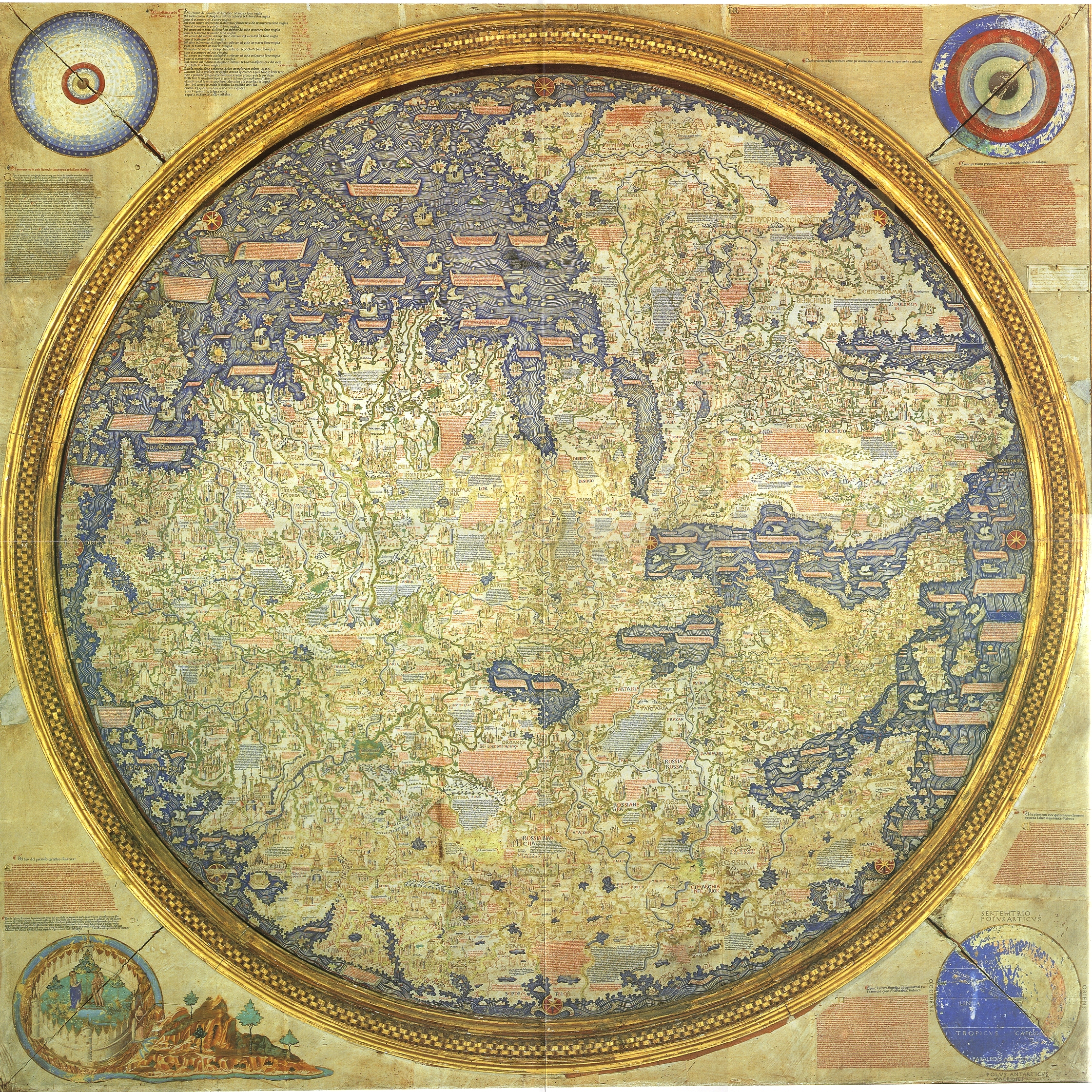
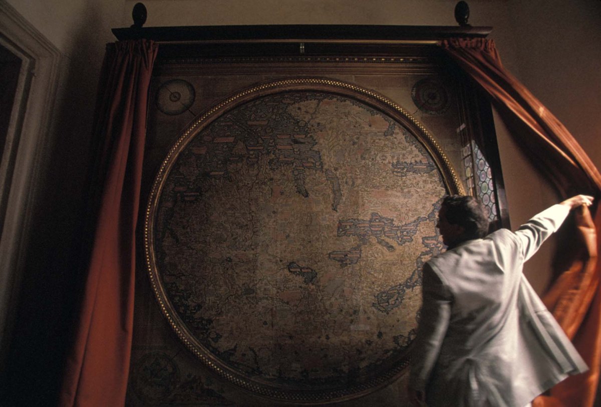
Map of the world by Fra Mauro, c.1450. South is up.
(This map looks amazing in its current location in Venice.)
Bill Rankin, 2014
with Aaron Reiss
click on each map to download
Aaron Reiss recently wrote an interview–profile for The Atlantic's CityLab where I discuss my five favorite maps. These maps were selected from an original list of ten, and I figured that I'd post all ten here for your viewing pleasure.
Besides just sharing some fun maps, however, I should also say that selecting these maps and talking about them was a remarkably productive exercise. Not surprisingly, my hard drive and my shelves are filled with thousands of maps from all over the world, and I tend to save a copy of pretty much every map that catches my eye. But having to choose just ten — ten maps that are each spectacular on their own but also work together as a group — forced me to think as both a designer and a historian at the same time. The selections are (of course) personal and idiosyncratic, but they also tell a story about map-making in general. This is not a story of "progress" — increasingly accurate maps showing more and better data — but rather a story about how each culture makes its own world through maps. Every one of these maps is full, complete, and embedded within a particular historical moment.
In other words, these are not the "ten best maps of all time." They are simply ten radically different ways of constructing and inhabiting the world.
