|
|
|
|
|
|
|
|
|
Bill Rankin, 2010
click on any tile for a high-resolution version
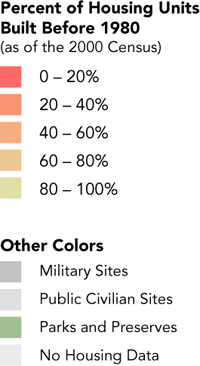
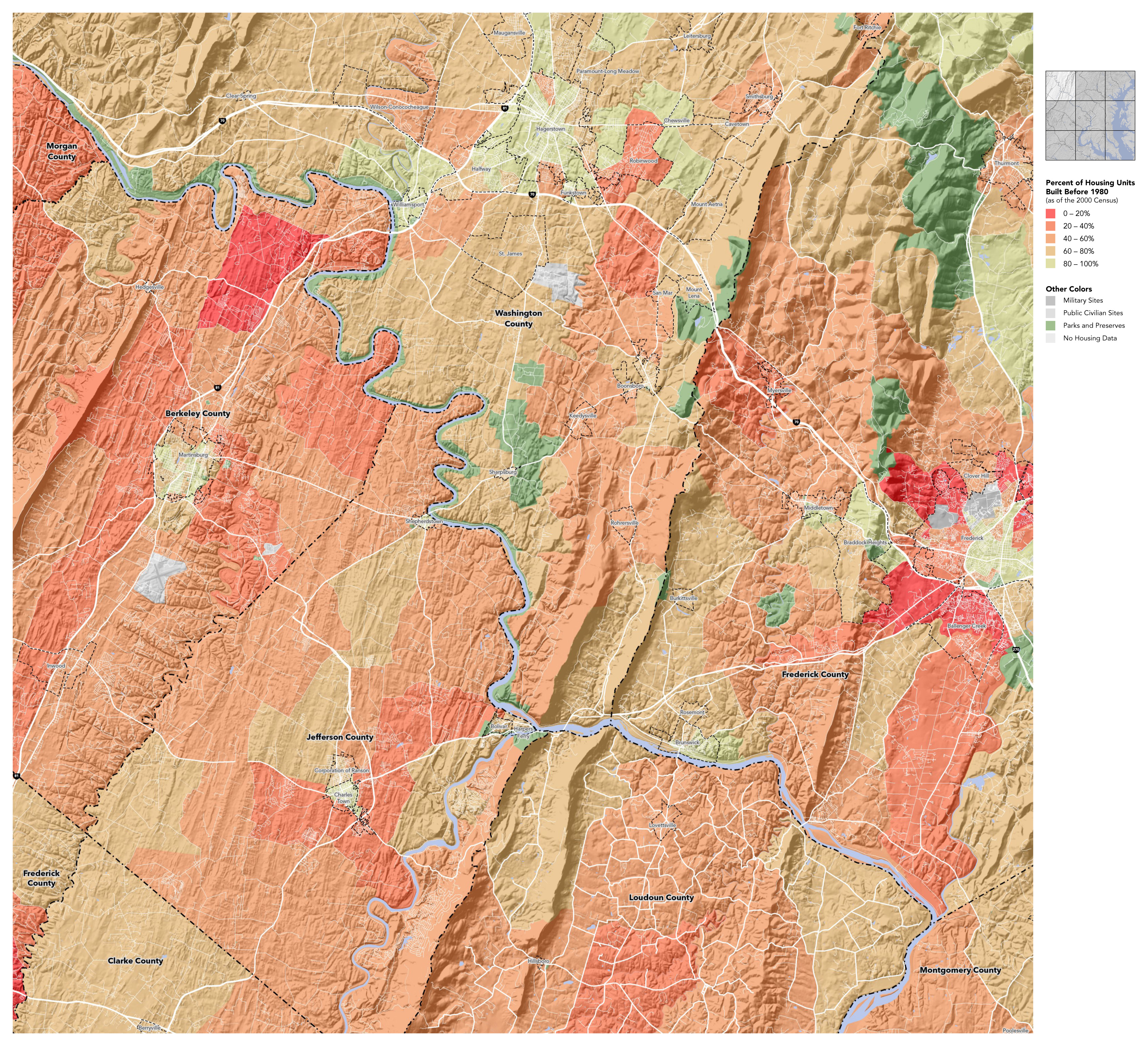
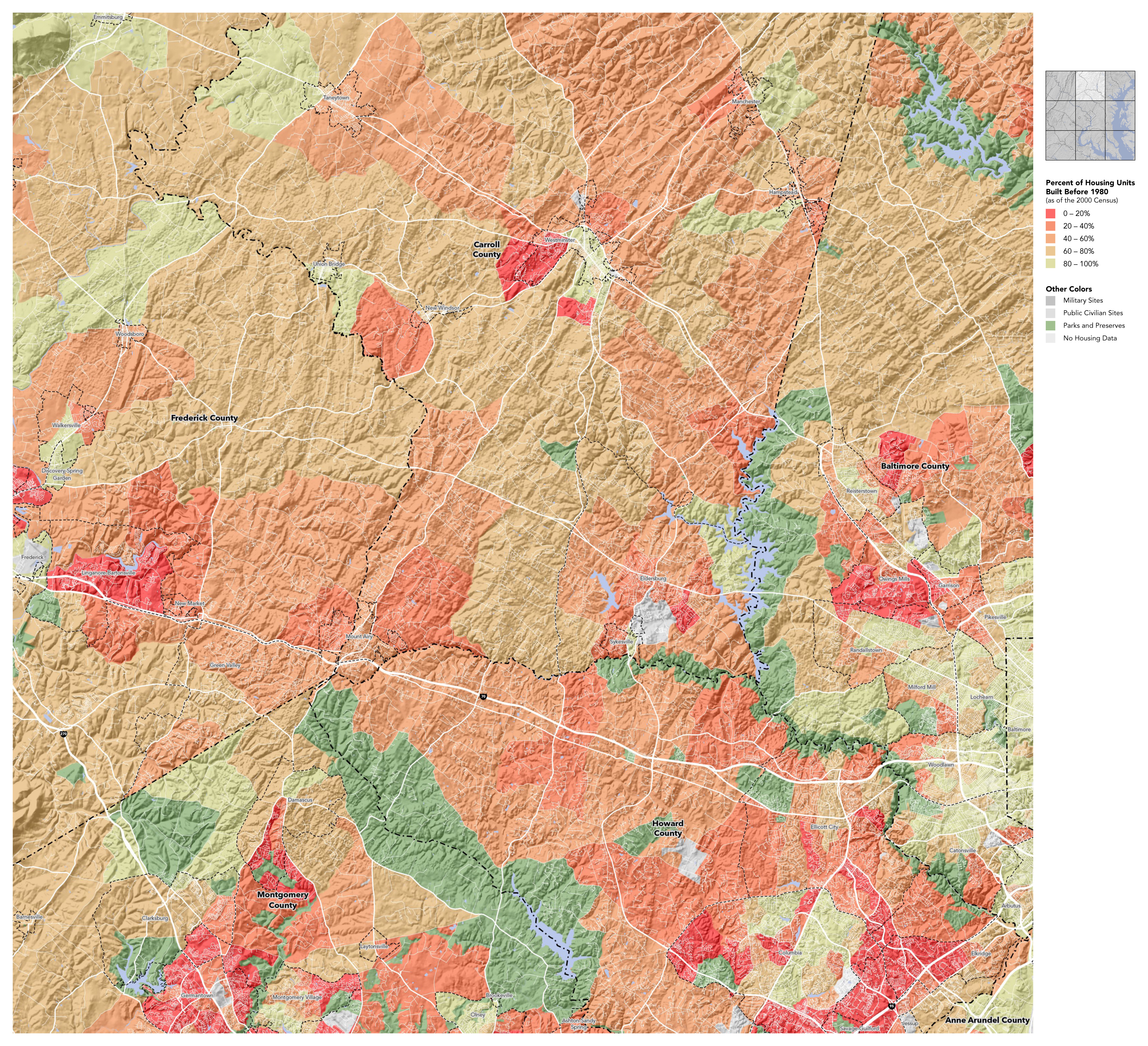
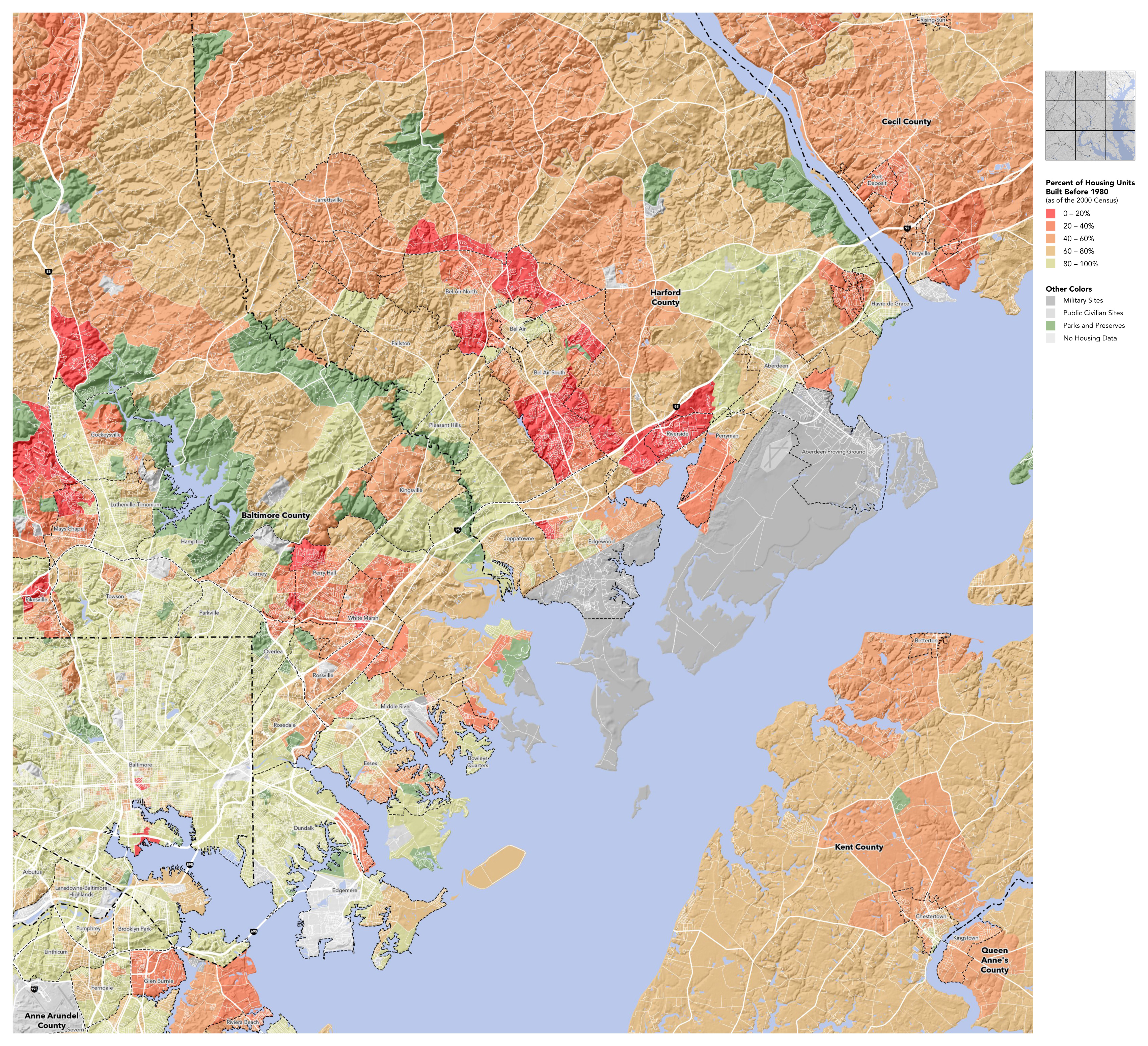
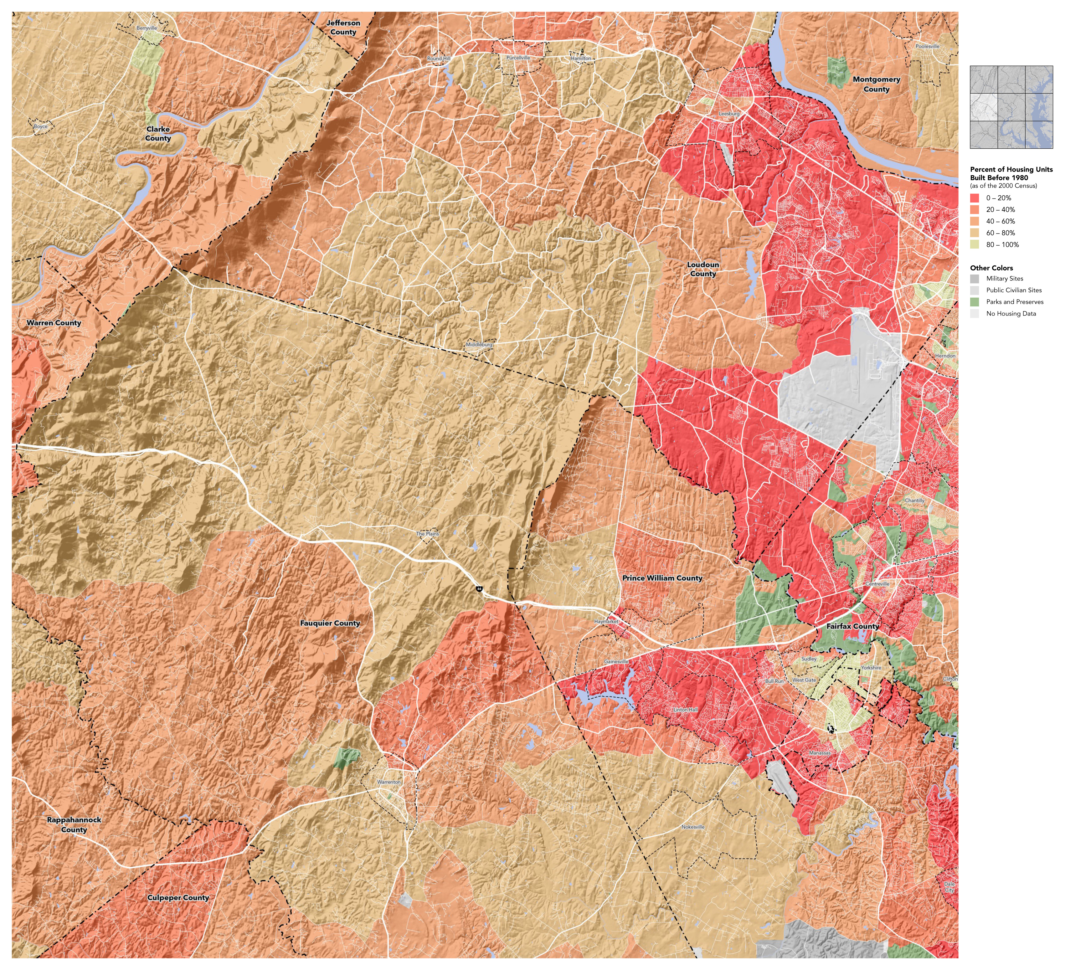
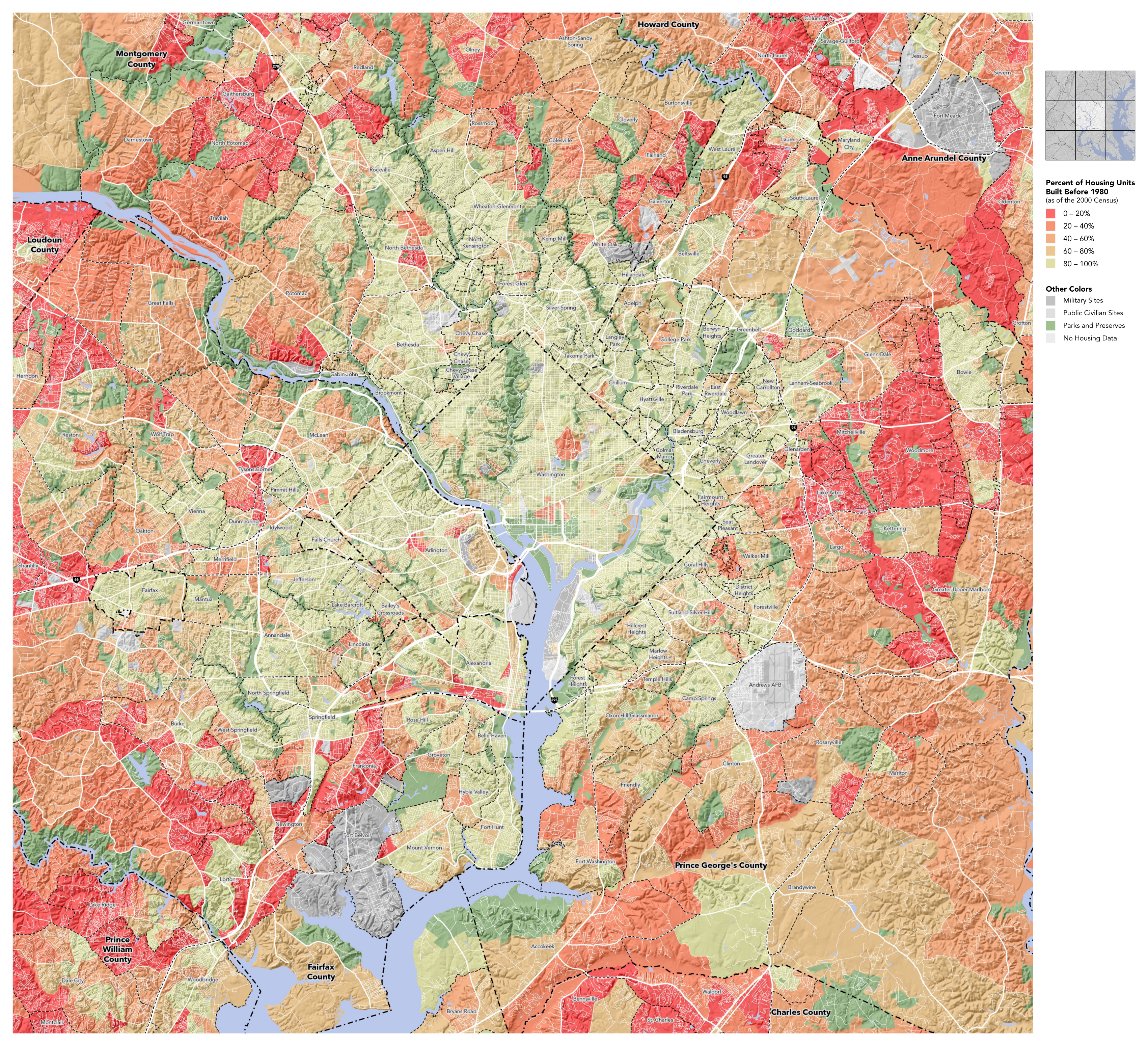
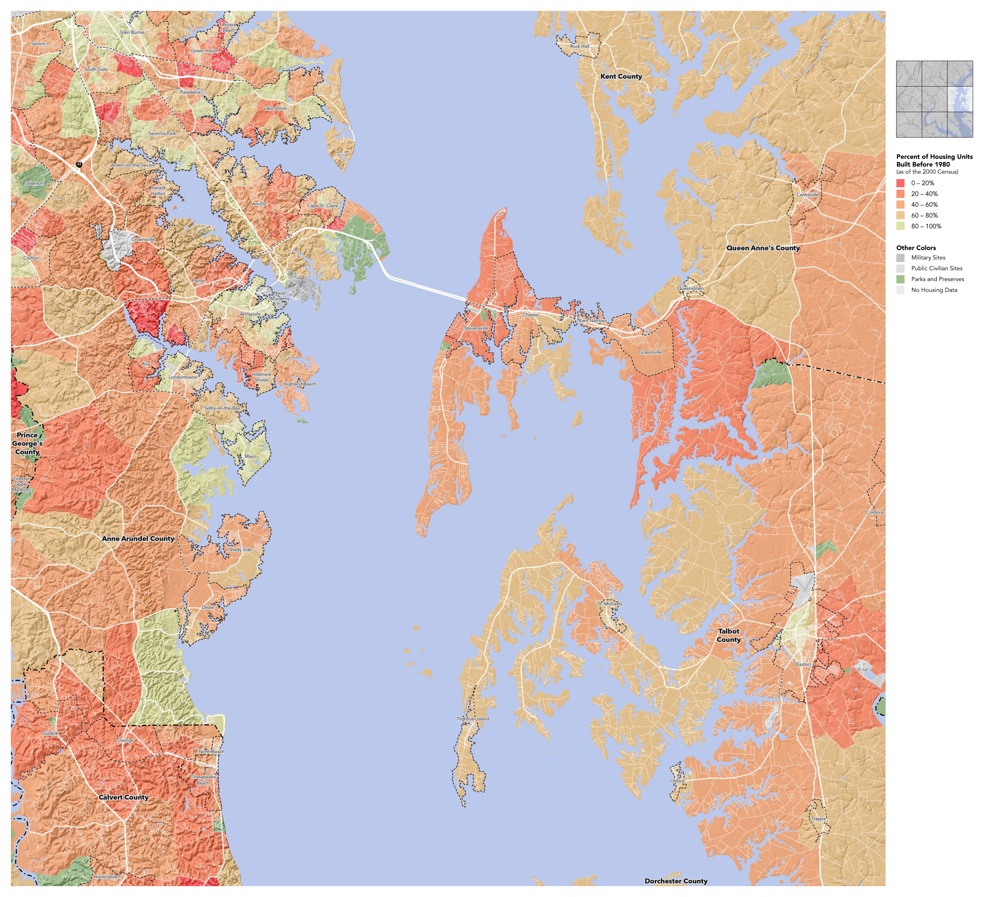
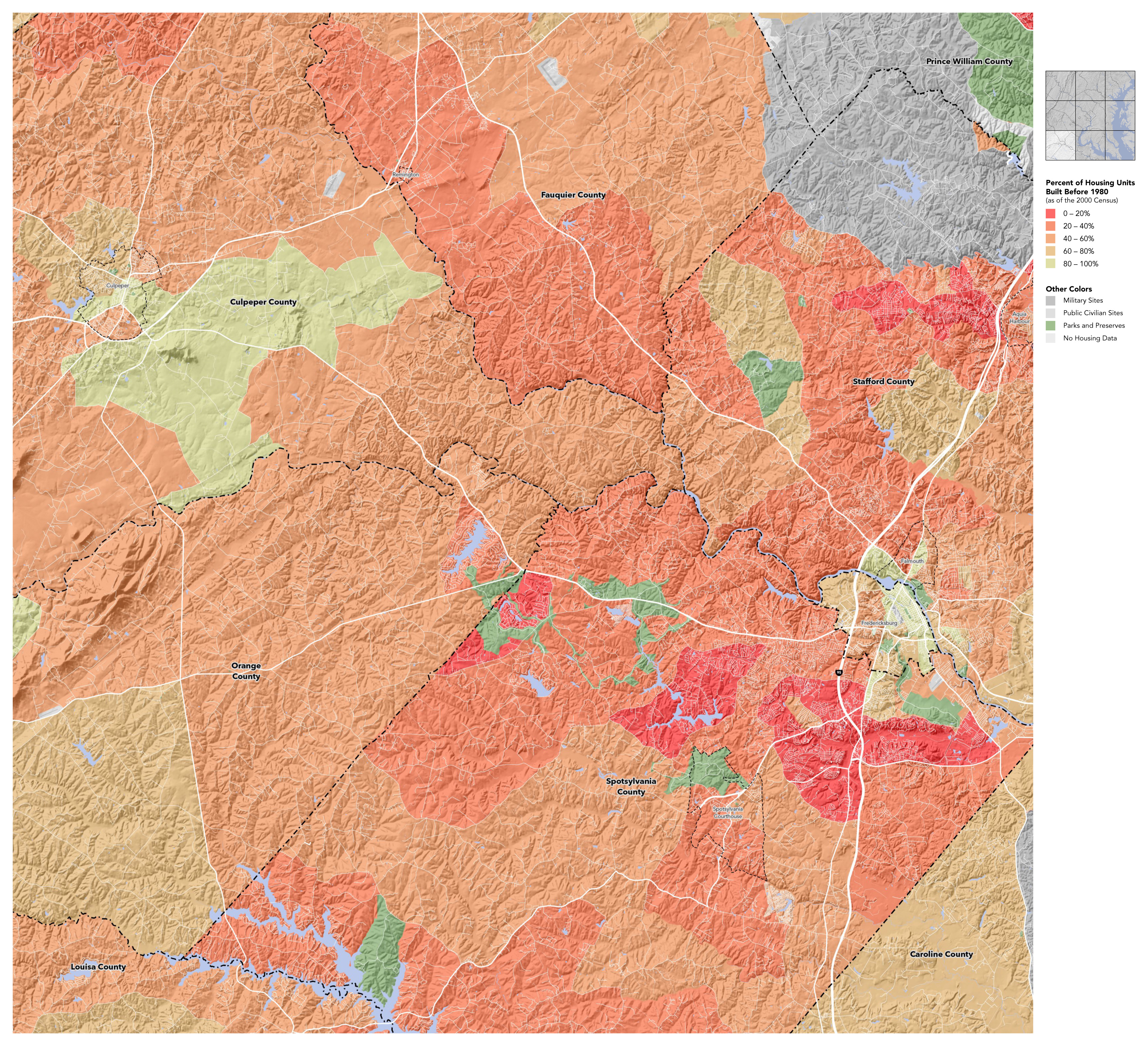
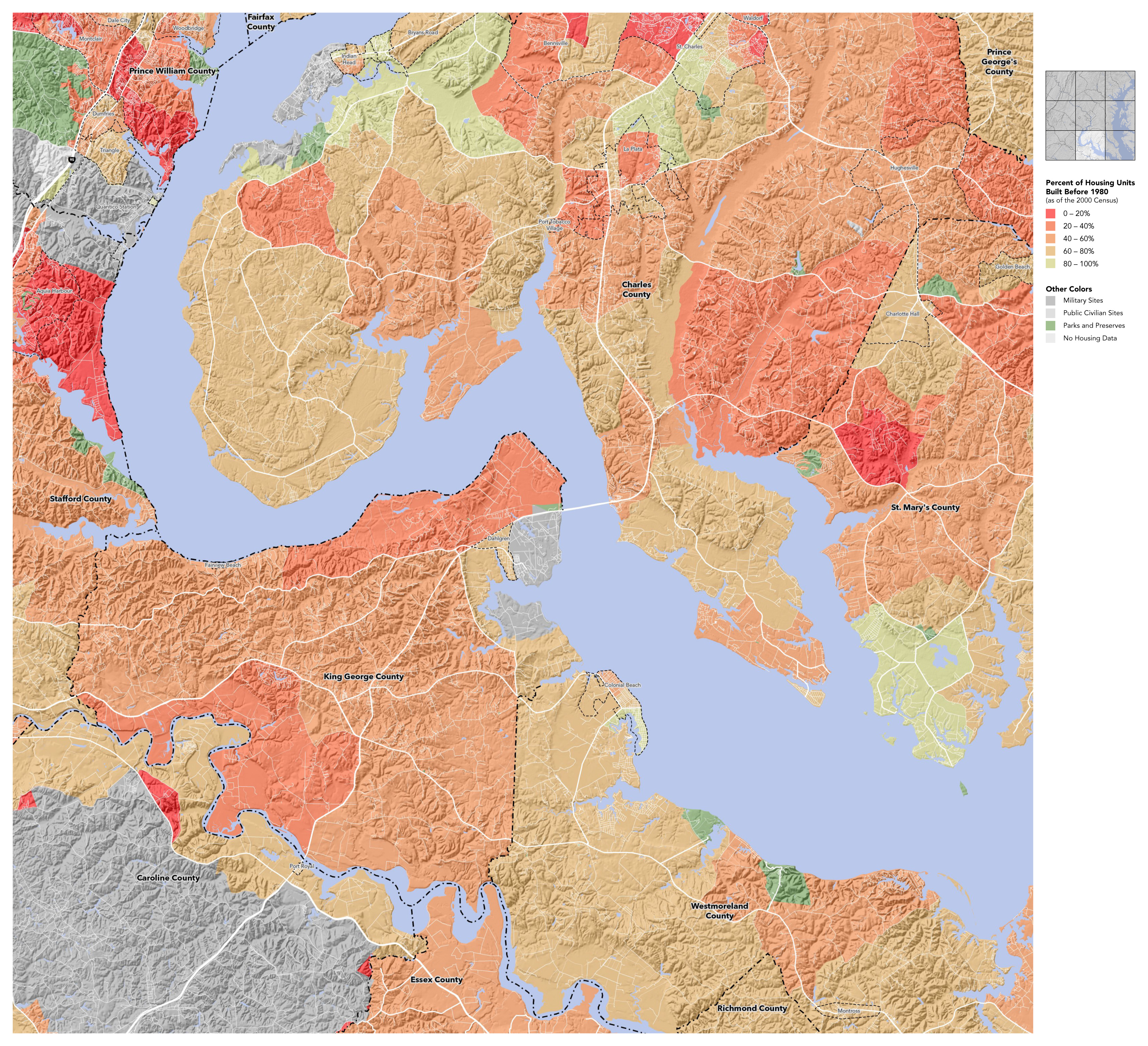
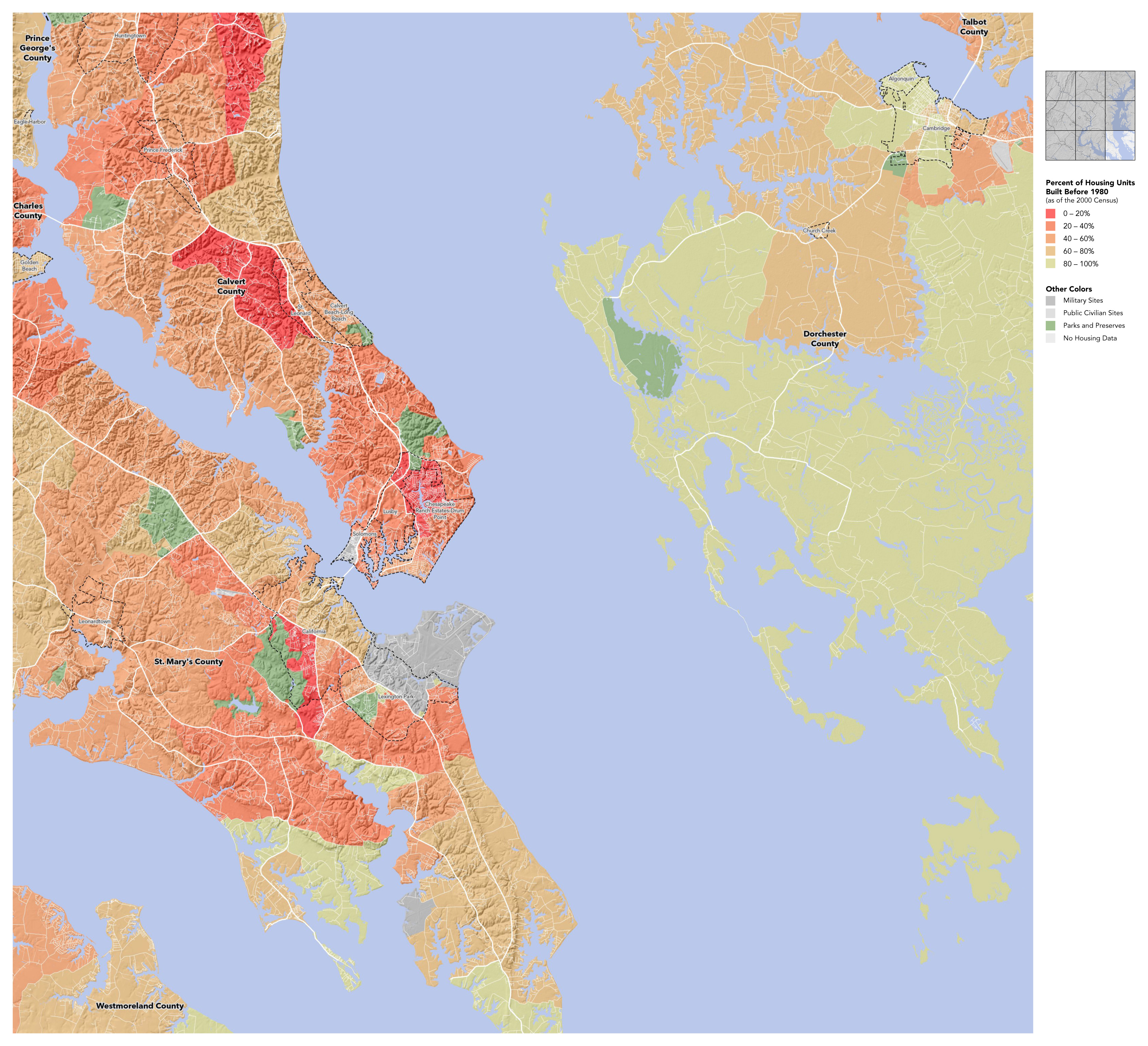
A simple set of wall maps showing the recent development of the DC/Baltimore area — notice the older urban core surrounded by a new exurban ring, both within a countryside of intermediate age. Housing construction offers a rather different way of defining the urban/rural boundary than demographic analysis by population density. Both, of course, have their uses.
It's interesting to compare these maps to the similar map of Chicagoland. Whether mapping old housing or new, the pattern is the same.
Data from the US Census.
